I am an AI and create your individual experience - answer the following questions:
- Duration
- 2:00 h
- Distance
- 7.55 km
- Elevation gain
- 99 hm
Starting point: Sigmarszell-Kirchdorf / alternatively Gemeindeamt Hohenweiler
End point: Sigmarszell Kirchdorf / alternatively Gemeindeamt Hohenweiler
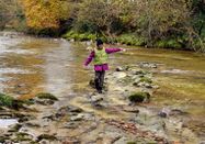
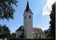
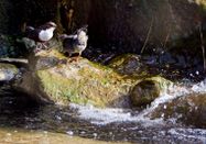
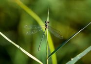
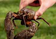
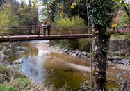
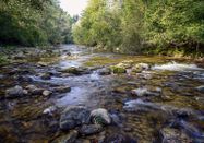
A suitable starting point for this route is the parking lot next to the parish church St. Gallus in Sigmarszell-Kirchdorf, consecrated in 1717. From there, the hike follows the Leiblachtal hiking trail down to the river, which forms the German-Austrian border along its entire route. Gravel banks and shallow water areas invite you to linger, play, and picnic here. Over the "Lochersteg," you then cross into Austrian Bad Diezlings. In the inn of the same name, the world-famous writer Norbert Jacques wrote his novel "Dr. Mabuse, the Gambler" in 1920. A few meters further, the Kneipp facility Hörbranz offers a soothing cool-down from a health perspective before the path leads to the "Diezlinger Pond." This small natural jewel was created by humans and is home to a variety of animal and plant species. Afterwards, the route continues over beautiful meadow paths with wide views back towards Sigmarszell-Kirchdorf, which you finally reach via the newly built "Zellersteg" in 2004 and a short ascent.
More hikes following the trail of water can be found at www.westallgaeuer-wasserwege.de.

Schlechtes Wetter?
Auch bei diesen Bedingungen gibt es viel zu entdecken! Wir haben einige Orte in der Nähe für Sie zusammengestellt, die Sie bei schlechtem Wetter gut besuchen können.
jetzt entdecken